Back كاجانج ARZ Каджанг Bulgarian Kajang Czech Kajang Esperanto کجانگ Persian Kajang (Selangor) French Kajang IBA Kajang, Malaysia ID Kajang Italian 카장 Korean
This article needs additional citations for verification. (April 2015) |
Kajang | |
|---|---|
Town | |
| Kajang Town Bandar Kajang | |
| Other transcription(s) | |
| • Jawi | کاجڠ |
| • Chinese | 加影 Jiāyǐng (Hanyu Pinyin) gaa1 jing2 (Jyutping) |
| • Tamil | காஜாங் Kājāṅ (Transliteration) |
 | |
| Motto(s): Kajang Bandar Pilihan untuk Didiami (Kajang: The Ideal City for Living) | |
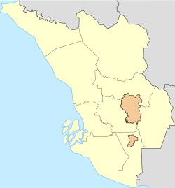
 Location in Malaysia | |
| Coordinates: 2°59′35″N 101°47′20″E / 2.99306°N 101.78889°E | |
| Country | Malaysia |
| State | Selangor |
| Establishment | 1709 |
| Granted municipal status | 1 January 1997 |
| Granted city status | TBA |
| Government | |
| • Yang Di-Pertua (President) | Nazli Md Taib |
| Area | |
| • Town | 93.4 km2 (36.1 sq mi) |
| • Urban | 790.43 km2 (305.19 sq mi) |
| Population (2020[2]) | |
| • Town | 236,240 |
| • Density | 1,326/km2 (3,393/sq mi) |
| • Metro | 1,047,356[1] |
| Time zone | UTC+8 (MST) |
| • Summer (DST) | Not observed |
| Postal codes in Malaysia | 43000 43200 43500 43650 |
| Calling code | +60-3-87 +60-3-89 +60-3-90 |
| Website | www |
Kajang is a town in Hulu Langat District, Selangor, Malaysia, located southeast of Kuala Lumpur. Kajang, along with much of Hulu Langat District, is governed by the Kajang Municipal Council. Kajang town is located on the eastern banks of the Langat River. It is surrounded by Cheras, Semenyih, Bangi, Putrajaya and Serdang.
According to the 2020 census, the local authority area (which includes Kajang, Cheras, Balakong, Bangi, Semenyih and Pekan Hulu Langat) has a population of 1.05 million people.[3]
- ^ "MyCenDash". Retrieved 1 June 2022.
- ^ "LATAR BELAKANG PEJABAT DAERAH / TANAH HULU LANGAT". Retrieved 27 April 2022.
- ^ "MyCenDash". Retrieved 1 June 2022.


